The Tidal Currents module of ScanNav allows you to overlay the currents to your charts, in real time, or at any selected day and time. You can plan your navigation according to these, either manually, or in conjunction with the new Routing module, available from version 17 of ScanNav (release planned for the Paris 2016 show). It also provides access to the Currents Grib file download service based on data issued from Mercator / MyOcean.
The calculation of currents is dependent on the SnTides water height module which is included in the base module.
The currents source data are issued either from the SHOM UJA data, the UKHO data, or GRIB files download service.

Service Hydrographique et Océanographique de la Marine - France –
Contrat n° 30/2005 - www.shom.fr
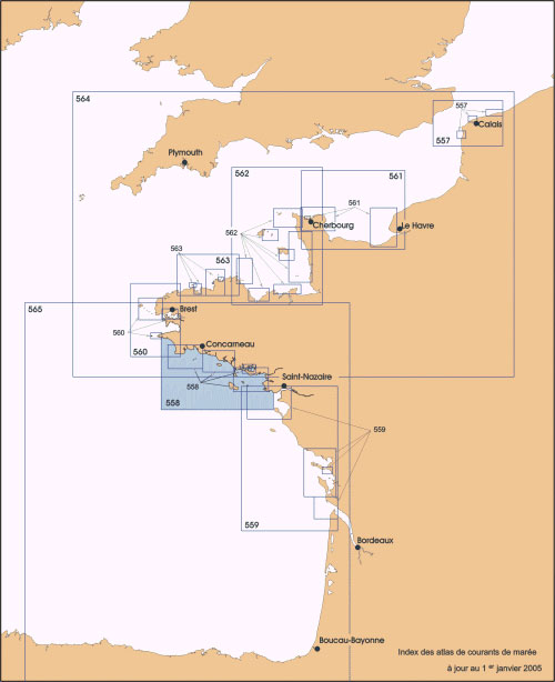
Currents data issued from SHOM data (reproduction authorization No. 30/2005) are the equivalent of the UJA paper Atlas, with the same breakdown (9 Atlas). They cover the Channel and Atlantic coasts of France.
The atlases can be purchased individually, or in packs, via the order form.
Unlike Grib files, the data is preinstalled with ScanNav, and does not require any additional download.
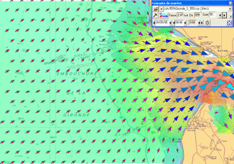
Each current zone corresponds to a paper Atlas of SHOM. Click on the zone number in the map opposite, or in the list below for details on each area
| N° | Designation | Edition | Price |
|---|---|---|---|
| UJA557 | Pas de Calais | 1988 | 40 |
| UJA558 | Côte Sud Bretagne d'Audierne au Croisic | 2005 | 40 |
| UJA559 | Côte Ouest Saint-Nazaire à Royan | 2001 | 40 |
| UJA560 | Côte Ouest Bretagne Goulven à Penmarc'h | 1994 | 40 |
| UJA561 | Baie de Seine, de Cherbourg à Fécamp | 1996 | 40 |
| UJA562 | Golfe Normand - Breton, de Cherbourg à Paimpol | 1998 | 40 |
| UJA563 | Côte Nord de Bretagne, des Héaux-de-Bréhat à la Pointe de Pontusval | 1999 | 40 |
| UJA564 | La Manche, de Dunkerque à Brest | 2000 | 40 |
| UJA565 | Golfe de Gascogne | 2002 | 40 |
This product has been derived in part from material obtained from the UK Hydrographic Office with the permission of the UK Hydrographic Office, the Keeper of Public Records.
http://www.ukho.gov.uk
| N° | Designation | Edition | Price |
|---|---|---|---|
| UKHO1500 | Royaume Uni, Belgique, Pays-Bas, Mer du Nord, Points éparses Iceland, Gibraltar, Portugal | 2011 | 20 |
data issued from Mercator/MyOcean
http://marine.copernicus.eu/
ScanNav hosts a GRIB download service with Currents data issued from Mercator - MyOcean.
These data are transformed into Grib files by the ScanNav server, and updated several times per day.
The Grib files can be downloaded directly using the http protocol, or by email requests. They are compressed so as to limit download times.
This service is included free of charge with the Currents module, but you must first register to create an account. Click here to access the registration form. This account is common with the weather Gribs download service.
The models used to generate the Grib files are the following:
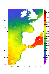
IBI Model (Iberian Irish Biscay):
|
|
|
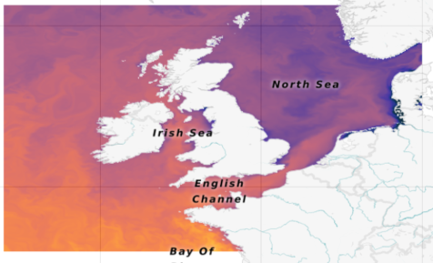
NWS Model (European North Western Shelf):
|
|
|
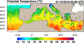
Mediterranean Model:
|
|
|
New model available from version 21.2
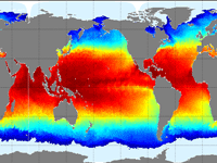
Global Worldwide Model:
|
|
|
|
You also have access to the Ocean currents Grib files from the RTOFS model of Noaa with global coverage at a resolution of 1/12° giving forecasts up to 8 days in steps of 3 hours.
The model can be downloaded by email via SailDocs. |
||
ScanNav is also compatible with other sources of Currents in Grib format available on the net. For example the German BSH provides Currents data for the following areas:
- North Sea 48.5°N/004.0°W to 60.0°N/010.0°E, grid 6 nm, 1 h
- German Bight 53.3°N/007.5°E to 54.5°N/009.3°E, grid 1 nm, 5 h
- Baltic Sea 52.0°N/010.0°E to 68.8°N/030.0°E, grid 6 nm, 1 h
- Western Baltic 53.2°N/009.5°E to 56.4°N/014.8°E, grid 1 nm, 1 h
As an example, to obtain GRIB Currents data for North Sea and Chanel Sea:


